LC 00153: verschil tussen versies
Geen bewerkingssamenvatting |
Geen bewerkingssamenvatting |
||
| Regel 9: | Regel 9: | ||
=== Flood risks === | === Flood risks === | ||
* ''Storm surges''. The storm surges tend to come from the north when the water, the wind and the moon combined results in high water in both the river and the North Sea. This happens about once or twice a year and the last heavy occurrence was in 2017. | * ''Storm surges''. The storm surges tend to come from the north when the water, the wind and the moon combined results in high water in both the river and the North Sea. This happens about once or twice a year and the last heavy occurrence was in 2017. However, the target areas for this project are not subject to storm surges. | ||
* ''Surface water flooding due from heavy rainfall.'' The area tends to be flat but there are a number of hills where properties are located. Great Yarmouth is built on a medieval sandbank town of fishermen with very narrow roads (1-2 meters), there are a range of houses from medieval to modern. | * ''Surface water flooding due from heavy rainfall.'' The area tends to be flat but there are a number of hills where properties are located. Great Yarmouth is built on a medieval sandbank town of fishermen with very narrow roads (1-2 meters), there are a range of houses from medieval to modern. Bradwell is a growing village with mainly post 1930 buildings. Gorleston has a great number of terraced houses built on hills, with very small gardens often surfaced with concrete. These different areas therefore have particular physical characteristics which affect the ability to install waterbutts and raised beds. For example, small terraced properties can only fit certain products. Within the area, the drainage system collects sewage and rain water. When it rains heavily the drains do not have the capacity to hold the water, resulting in flooding of houses located in the lower part on the drainage system. Generally, where houses are terraced, roads and gardens are made of concrete and increase the surface flooding in the area. For more on flood risks in this area, please visit the {{External link|resource=Resource Hyperlink 00580|name=Norfolk County Council webpage|dialog=process-linkwebsite-dialog}}. | ||
{{Light Context | {{Light Context | ||
Huidige versie van 30 jun 2020 om 10:22
Area description
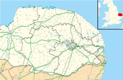
The scope location of the pilot project is north of Great Yarmouth, Gorleston and a village close by called Bradwell. It is a low lying area where Great Yarmouth and Gorleston are located below sea level. In terms of geography Great Yarmouth is formed by sand banks from the sea so it is not that old as Gorleston.
Size: the pilot area covers 10.075 km2
Number of inhabitants: 38.693
Relevant characteristics of the water system: the River Yare cuts off Great Yarmouth from other areas of the borough.The County borders the North Sea.
Flood risks
- Storm surges. The storm surges tend to come from the north when the water, the wind and the moon combined results in high water in both the river and the North Sea. This happens about once or twice a year and the last heavy occurrence was in 2017. However, the target areas for this project are not subject to storm surges.
- Surface water flooding due from heavy rainfall. The area tends to be flat but there are a number of hills where properties are located. Great Yarmouth is built on a medieval sandbank town of fishermen with very narrow roads (1-2 meters), there are a range of houses from medieval to modern. Bradwell is a growing village with mainly post 1930 buildings. Gorleston has a great number of terraced houses built on hills, with very small gardens often surfaced with concrete. These different areas therefore have particular physical characteristics which affect the ability to install waterbutts and raised beds. For example, small terraced properties can only fit certain products. Within the area, the drainage system collects sewage and rain water. When it rains heavily the drains do not have the capacity to hold the water, resulting in flooding of houses located in the lower part on the drainage system. Generally, where houses are terraced, roads and gardens are made of concrete and increase the surface flooding in the area. For more on flood risks in this area, please visit the Norfolk County Council webpage.
Hier wordt aan gewerkt of naar verwezen door: Layer 1- Flood protection

