LC 00031: verschil tussen versies
Geen bewerkingssamenvatting |
Geen bewerkingssamenvatting |
||
| Regel 1: | Regel 1: | ||
== Area description == | |||
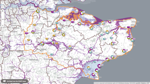
[[Bestand:Map Kent.png|links|miniatuur|Map of pilot area: flood risk to health and social care properties in Kent.]] | |||
{{Light Context | {{Light Context | ||
|Supercontext=FR PLT PR 00005 | |Supercontext=FR PLT PR 00005 | ||
Versie van 6 sep 2019 08:20
Area description
Referenties
- Website with all UK government departments and many other agencies and public bodies, Government of the UK, 6 september 2019.
Hier wordt aan gewerkt of naar verwezen door: Layer 1- Flood protection, Layer 1- Flood protection, Project outcomes and beyond

