Pilot description
Area description
Number of inhabitants: to be added
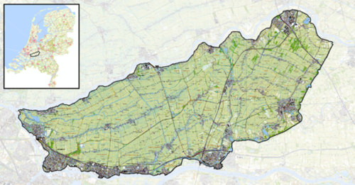
Relevant characteristics of the water system: Alblasserwaard - Vijfheerenlanden is an area in the province of Zuid Holland and lies between the rivers the Lek, the Merwede, the Noord and the Linge.
Flood risks
The Dutch strategy focuses mainly on layer 1, prevention. This region, too, counts on the safety delivered by the dikes - it is literally surrounded by dikes (dikering 16). The region tilts from east to west and is is two metres below sea level and during a flooding event the water level can rise up to 4 metres in relation to NAP (average sea level).
The calculated risk for dike ring 16 is high compared to calculated flood risks for other dikerings in the Netherlands (Vergouwe et al., 2014).
Referenties
- CBS, CBS, 1 januari 2020.
- Overstromingsrisico Alblasserwaard Vijfheerenlanden, Vergouwe et al., Rijkswaterstaat WVL, 1 mei 2014.
Hier wordt aan gewerkt of naar verwezen door: Layer 1- Flood protection

