|
|
| Regel 44: |
Regel 44: |
| | Project[Show sources]=Nee | | | Project[Show sources]=Nee |
| }} | | }} |
| -->Floods have always been and will continue to be part of our daily reality. In fact, floods are amongst the world’s most common and most devastating natural hazards and have affected millions of people in Europe since the beginning of this century. Changes in our climate are increasing the risk of river and coastal flooding because sea levels are rising and rainfall patterns are becoming more extreme. Increasing flood risks call for more innovative approaches to minimize the impacts of such events. Therefore, five countries bordering the North Sea Region, Denmark, Germany, the Netherlands, Belgium and the United Kingdom, are joining forces in the Interreg North Sea Region project FRAMES. | | -->FRAMES stands for Flood Resilient Areas by multi-layEr Safety. Traditionally, structural and static solutions were the preferred management option to defend against flooding. However, it is more and more recognized that protection alone will not be enough to make areas climate-resilient. It is also imperative to decrease the effects of flooding and look at spatial planning and disaster management as well. This so-called Multi-Layered Safety approach is thus based on three layers: 1) protection, the primary dike system; 2) sustainable spatial planning that decreases the loss should a flood occur; and 3) disaster management, the organizational aspects related to a flood event. Together, these three layers can be tailored to local areas in order to minimise flood damage. |
| | |
| FRAMES stands for Flood Resilient Areas by multi-layEr Safety. Traditionally, structural and static solutions were the preferred management option to defend against flooding. However, it is more and more recognized that protection alone will not be enough to make areas climate-resilient. It is also imperative to decrease the effects of flooding and look at spatial planning and disaster management as well. This so-called Multi-Layered Safety approach is thus based on three layers: 1) protection, the primary dike system; 2) sustainable spatial planning that decreases the loss should a flood occur; and 3) disaster management, the organizational aspects related to a flood event. Together, these three layers can be tailored to local areas in order to minimise flood damage. | |
| | |
| In FRAMES, we look at how MultiLayered Safety can improve the overall resilience of areas, communities and authorities in 13 pilot areas. Via a learning evaluation approach pilots are compared and transnational focus groups are organized to evaluate and learn from transnational (intermediate) results. This learning process allows uss to generate new insights, support future decision making and show innovative solutions to improve society’s ability to cope with flooding. FRAMES runs from October 2016 till January 2020.
| |
| | |
|
| |
|
| | Floods have always been and will continue to be part of our daily reality. In fact, floods are amongst the world’s most common and most devastating natural hazards and have affected millions of people in Europe since the beginning of this century. Changes in our climate are increasing the risk of river and coastal flooding because sea levels are rising and rainfall patterns are becoming more extreme. Increasing flood risks call for more innovative approaches to minimize the impacts of such events. Therefore, five countries bordering the North Sea Region, Denmark, Germany, the Netherlands, Belgium and the United Kingdom, are joining forces in the Interreg North Sea Region project FRAMES. |
| <!-- | | <!-- |
| {{#ask: [[Category:Project]] [[Supercontext::{{PAGENAME}}]] | | {{#ask: [[Category:Project]] [[Supercontext::{{PAGENAME}}]] |
| Regel 63: |
Regel 59: |
|
| |
|
| [[Bestand:FRAMES Interreg NSR logo.jpg|miniatuur]] | | [[Bestand:FRAMES Interreg NSR logo.jpg|miniatuur]] |
| | |
| | |
|
| |
|
|
| |
|
Versie van 14 mrt 2019 11:36
FRAMES stands for Flood Resilient Areas by multi-layEr Safety. Traditionally, structural and static solutions were the preferred management option to defend against flooding. However, it is more and more recognized that protection alone will not be enough to make areas climate-resilient. It is also imperative to decrease the effects of flooding and look at spatial planning and disaster management as well. This so-called Multi-Layered Safety approach is thus based on three layers: 1) protection, the primary dike system; 2) sustainable spatial planning that decreases the loss should a flood occur; and 3) disaster management, the organizational aspects related to a flood event. Together, these three layers can be tailored to local areas in order to minimise flood damage.
Floods have always been and will continue to be part of our daily reality. In fact, floods are amongst the world’s most common and most devastating natural hazards and have affected millions of people in Europe since the beginning of this century. Changes in our climate are increasing the risk of river and coastal flooding because sea levels are rising and rainfall patterns are becoming more extreme. Increasing flood risks call for more innovative approaches to minimize the impacts of such events. Therefore, five countries bordering the North Sea Region, Denmark, Germany, the Netherlands, Belgium and the United Kingdom, are joining forces in the Interreg North Sea Region project FRAMES.
Subprojecten
| Project | Startdatum | Einddatum | Samenvatting |
|---|
| About | 6 februari 2019 | | About FRAMES. |
| Belgium | 1 oktober 2016 | 30 april 2020 | Within FRAMES, the Province of East-Flanders and Ghent University will investigate the possibilities of individual and community-based flood risk action and how it can be encouraged. In the flood-prone areas of Ninove, Geraardsbergen and Denderleeuw, participatory planning processes will unite inhabitants to explore the possibilities of this type of measures, their potential co-benefits and how citizens’ capacities can be strengthened to implement them. |
| Decision Support System | 1 oktober 2016 | 30 april 2020 | A road map to help involved authorities identify how governance relates to the resilience of flood prone areas. |
| Denmark | 1 oktober 2016 | 30 april 2020 | FRAMES enables the Danish Coastal Authority ( DCA) to exchange and share new knowledge and experiences from applied methods and actions with respect to flood risk management. Furthermore, the DCA will gain practice-based insight into spatial planning, emergency response and recovery processes concerning flood risk- and crisis management. |
| Final products | 24 april 2020 | | Final products of the FRAMES project can be found here: the Layman's report, the Policy recommendations report, the Transnational monitoring and evaluation report, dissemination material, |
| Germany | 1 oktober 2016 | 30 april 2020 | In this pilot, we will focus on the Wesermarsch region in the northwest of Germany. The Wesermarsch is surrounded on three sides by water: the Jade Bay on the western side, and the Weser river on the east which flows into the North Sea. There are two streams in the south, Hunte and Untere Ollen, that flow into the Weser river. FRAMES will strengthen layers 2 (pro-action/ prevention via spatial planning) and 3 (preparation & response) in this region, and the actors will be provided with the outcomes of this project that will enable them to implement more balanced FRM strategies in the Wesermarsch region. |
| Glossary | 9 juli 2019 | | Glossary |
| Pilots | 1 oktober 2016 | 31 juli 2020 | In FRAMES, we looked at how Multi-Layer Safety, or MLS, can improve the overall resilience of areas, communities and authorities in 16 pilot areas. Via a learning evaluation approach pilots are compared and transnational focus groups are organized to evaluate and learn from transnational (intermediate) results. This learning process allowed us to generate new insights, support future decision making and show innovative solutions to improve society’s ability to cope with flooding. FRAMES ran from October 2016 till July 2020. |
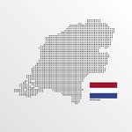
| The Netherlands | 1 oktober 2016 | 31 juli 2020 | The province of Zeeland is situated in the southwest of the Netherlands. It is bounded to Belgium on the south, the province of South-Holland on the north, the province of North-Brabant on the east and the North Sea on the west. Two estuaries cross the province: the Oosterschelde and the Westerschelde. The importance of the sea for the shaping of the province is well expressed in its name: Zee-land (literally translates to Sea-land), which indicates the situation of the province on the edge of water and land. |
| Toolkit | 10 juli 2019 | | |
| United Kingdom | 1 oktober 2016 | 30 april 2020 | FRAMES will demonstrate, across a diverse range of target sites, the multiple benefits that a catchment-based MLS approach can achieve. This will help to increase confidence in the approach and promote its use more widely.
FRAMES will help the Rivers Trust develop the skills, tools, approaches and partnerships needed to build capability within the Rivers Trust and CaBA (Catchment Based Approach) network to support communities in delivery of MLS and catchment-based flood risk management. |


