Pilot description
Area description
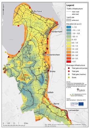
The Wesermarsch region lies in the northwest of Germany.
Number of inhabitants:89,282 inhabitants (Statistisches Bundesamt, 2016)
Relevant characteristics of the water system (main water bodies): the Wesermarsch is surrounded on three sides by water: the Jade Bay on the western side, The North Sea in the North, and The Weser river on the east which flows into the North Sea. In the South the Hunte River flows into the Weser river.
Flood risks
The region is flat and on average, it lies between 2 and 3 metres below sea level (NIBIS, 2019). Flood risks come from three sides: river, rain and sea. In case of a storm surge with dike breaches, the impact will be high because the area is low-lying and would be flooded quickly; in case of river or/and rainfall flooding impact is expected to be rather small and local.
The official flood hazard level for this region is 1, meaning 'not harmful' (Niedersächsisches Bodeninformationssystem, 2017).
Referenties
- Niedersächsisches Bodeninformationssystem, LBEG, 11 juni 2019.
- NIBIS, NIBIS, 11 juni 2019.
- Statistisches Bundesamt, Statistisches Bundesamt, 11 juni 2019.
Hier wordt aan gewerkt of naar verwezen door: Layer 1- Flood protection, Project outcomes and beyond

